This is part 3 of our road trip we took back in may. You can find Part 1 – Fruita, CO here and Part 2 – Overland Expo here.
We left Flagstaff, AZ and the Overland Expo bright and early on Monday morning, May 15, 2017. We packed up nearly everything the night before and were on the road by 0700. Our destination was the Mojave Road for our first truly 100% off grid 4×4 trip with our truck and trailer.
The Mojave Road starts about 10 miles SW outside Laughlin, NV (35.052000, -114.676210) but because of where we were traveling from, I decided to pick up the Mojave Road where it crosses CA Hwy 95 (at 35.113020, -114.829520) instead. The stretch of the Mojave Rd from Mile 0 to where we started takes a few hours and we didn’t have that time to spare on Day 1 because we were coming from Flagstaff. One can drive the Mojave Road in about 2 – 3 days, but we wanted to take it slower and stop and see as much as we could. There were also a number of hiking trails we wanted to try. So this wasn’t just going to be a drive across the desert. Instead of 2 – 3 days, we were looking at 4 nights and 5 days and we still couldn’t see everything we wanted to. To really see the Mojave, I think one needs about 6 nights and 7 days, if not longer.
We left Flagstaff fully charged and full of water in our trailer’s 21 gallon fresh water tank. Plus we had an extra 15 gallons of water and 20 extra gallons of gas in Jerry cans. We stopped in Laughlin to top off the truck’s fuel tank and hit the Safeway store for provisions, then it was off to our Mojave Road trail head.
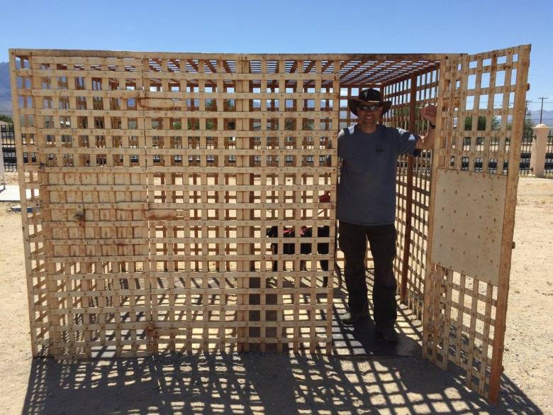
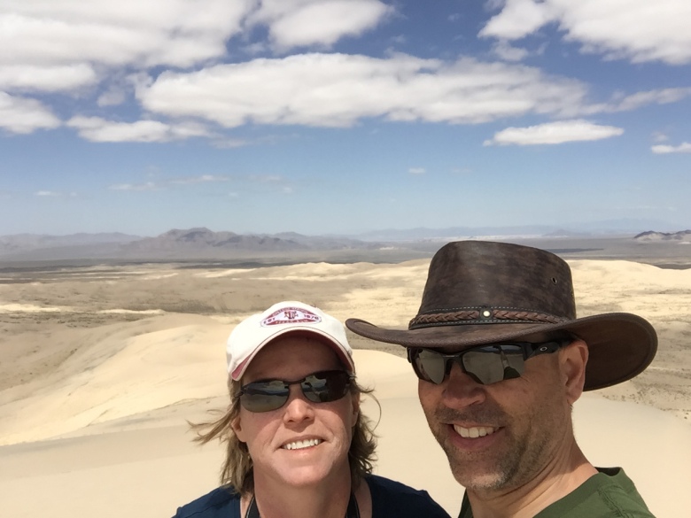
We pulled off CA Hwy 95 at our trail head to get our bearings, air down tires and take our ‘start of our trip’ selfie. Yes, I did buy a new hat for this trip.

We made good time from Flagstaff and got started earlier then I expected. However, this section of the Mojave Road we started on was terrible. It took us 90 minutes to drive the first 7 miles. I knew it would be slow, but that was real slow.
Our first stop was going to be Fort Piute (35.114844, -114.985142) but after getting to the turn off to it, we calculated how long it would take to get there and still make it our first night’s camp site and decided it would take too long. The problem with Fort Piute is that the road beyond the fort is impassable to everyone except for the best equiped off-road vehicles (so we’ve heard). We weren’t going to try it. This makes the side trip to the fort an out and back route instead of a route that passes through. We just didn’t have enough time now. So, unfortunately, we had to cancel our stop to Fort Piute.
Further, there is another wash-out I was aware of on the Mojave Rd (MP 27 – MP 30.5) that creates a 14 mile detour. The park service wants people to take a 29 mile detour, but there’s a shorter one I found in my research and we took it instead. It was very driveable. We met some Overland Bound members at the Expo who had driven the Mojave Rd in March and confirmed my research. Plus, they said even the section that is “closed” is passable. A number of their group took it and beat them to their first camp site by hours. I was tempted to take it since we were behind schedule, but decided to stay on the cautious side and take the 14 mile detour.
By passing up Fort Piute we did have time to stop at the Laser Ray Mine (35.027400, -115.033722). That gave us a chance to get out of the truck for a bit and stretch our legs and give Ripley some time outside. The mine’s ruins were pretty…..well, ruined. Not much to see. It would make for a good camp site, however. Something to remember for next time.
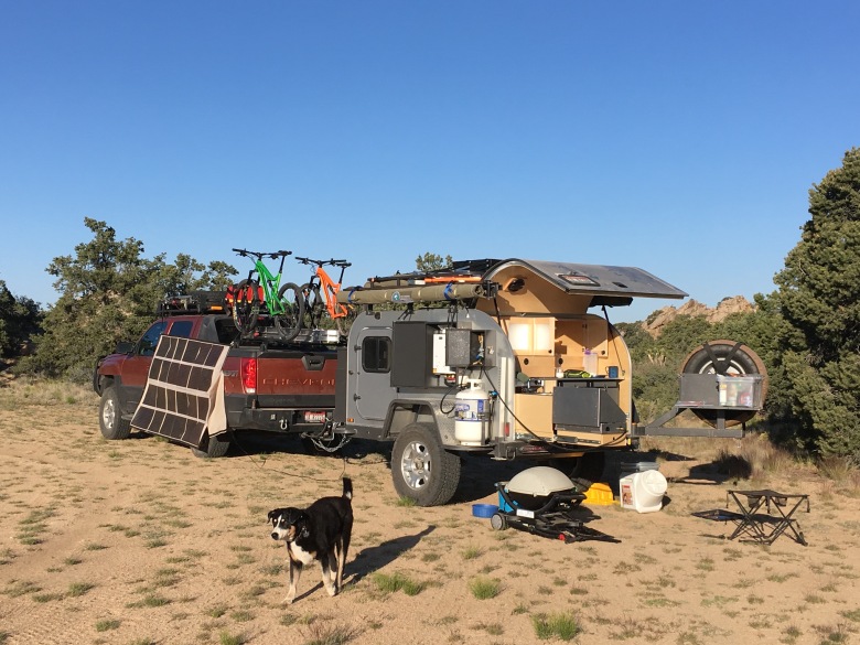
We climbed back into the truck and continued on. We didn’t get far before our first mechanical breakdown. The driver side shock on our trailer tore off its mount. At first, I thought it was the weld but upon closer inspection, the shock mount tore completely off the trailer’s frame leaving a hole in the frame rail. Well, that was a bit of a surprise……to say the least.

Another surprise was that I had cell service via Verizon on my work phone. I gave Moby 1 a call to ask about pulling the trailer on one shock. I spoke with Harrison who, surprisingly again, said this was a known problem to them as it has happened before and they have since incorporated a new mounting system on their trailers. Well, that would have been nice to know before we left Boise. I would have thought they might give current owners a heads up instead of finding this problem 17 miles into the Mojave Road.
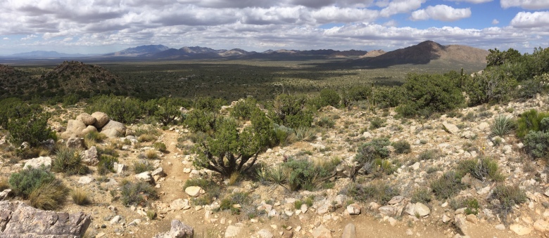
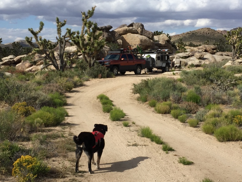
I took the shock off the trailer and we continued on. About 10 miles later, the passenger side shock tore off its mount. So now both shocks were gone. The trailer still did fine. It just had a bit more bounce in it over the rough road. We stopped by the Mojave Bus Camp (35.119550, -115.115130) and took some time to get out of the truck at high points in the trail to look around and explore a bit. Here are some photos of Day 1 on the Mojave Rd.

Stopping at a high point in the trail….seriously….to look out over the valley floor.

The Mojave Bus Camp. This would make a pretty nice group camping spot. Big turn around area and nice and flat. No real cover or break from any wind, however. And no, I didn’t put any rounds into the bus.

The Mojave Bus Camp.

Penny Can Tree. The story I read on this can goes back to when the Mojave Road was used for transportation and trading and crossed lots of private property. In fact, there is still a lot of private property out here along with homesteads. The owner of one section asked for donations using a can, like the one pictured, in a tree. Users of this section were asked to donate to the can to help offset his cost of maintaining the road. Yes, we kept with tradition and donated to the can as well.
We did finally make it to our first camp site in the New York Mountains (35.218872, -115.309633) but it was late. We had wanted to stay farther up Carruthers Canyon, but figured that might be another 30 minutes so we took this spot. There was a hike at the top of Caruthers Canyon I wanted to do on the morning of Day 2, but with how long it took us to drive around on Day 1, I was concerned we would run out of time, so we bypassed that hike on Day 2.
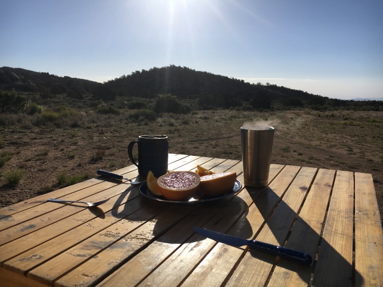
This camp site was really nice. Easy to get into, big area to turn around and might provide good shelter from any wind. Our evening was pretty calm. It was a good thing we didn’t go by Fort Piute or start at MP 0 after all. It was close to 2000 hrs by the time we set up for dinner…and it was actually cold. We huddled around the grill while we cooked hamburgers, ate and went to bed. Having left Flagstaff around 0700, it had been a long day.
The next morning we woke up with the sunrise. We set up the solar panel on the side of the truck to charge things up, made breakfast and enjoyed the morning.
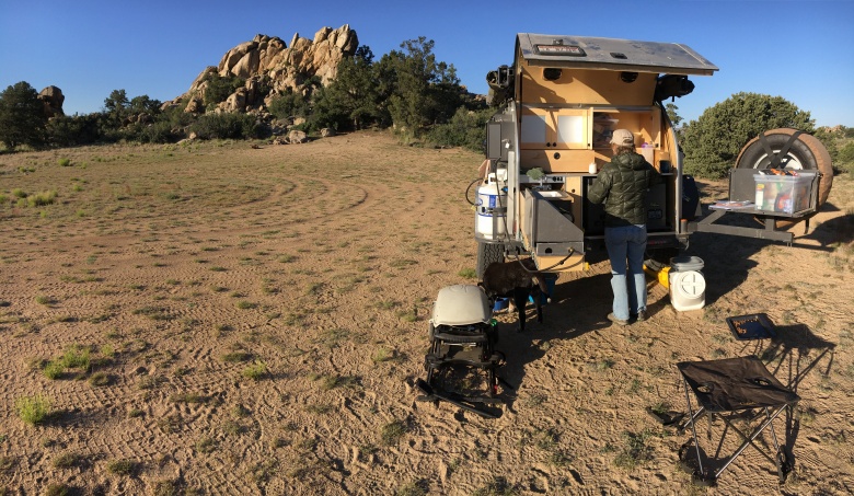
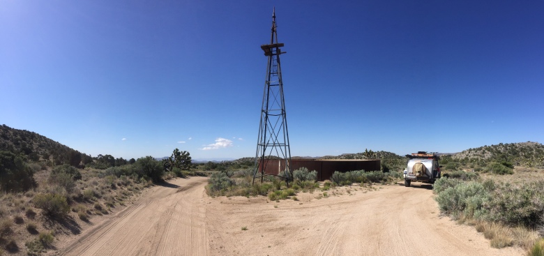
With no shocks on the trailer now, we decided that we would stick to the more improved sections of road in the Preserve and stay off the rougher sections. We did scout out some camp sites along Caruthers Canyon and visited the windmill (35.225351, -115.300387) in the area before we headed off to our next camp site. It appears the windmill powered a pump from this old water cistern. As we drove up this road, you can see remnants of the old pipe line along the side of the road, partially buried.
We made much better time by staying on the more improved sections of the road network in the Preserve and eventually made our way out to Granite Pass. On the way there, the trailer did well even without the shocks.
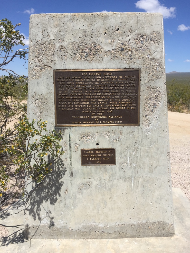
We stopped at the Mojave Monument where the Mojave Rd crosses the Kelso Cima Rd (35.176040, -115.509276).
We traveled down the Kelso Cima Rd and stopped by the visitor center in Kelso (35.218872, -115.309633) which is closed on Monday and Tuesday. It’s a cool area and I recommend stopping to check out the historical markers and the old jail they have set up.
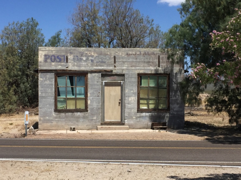
Some of the original Kelso buildings surrounding the area.
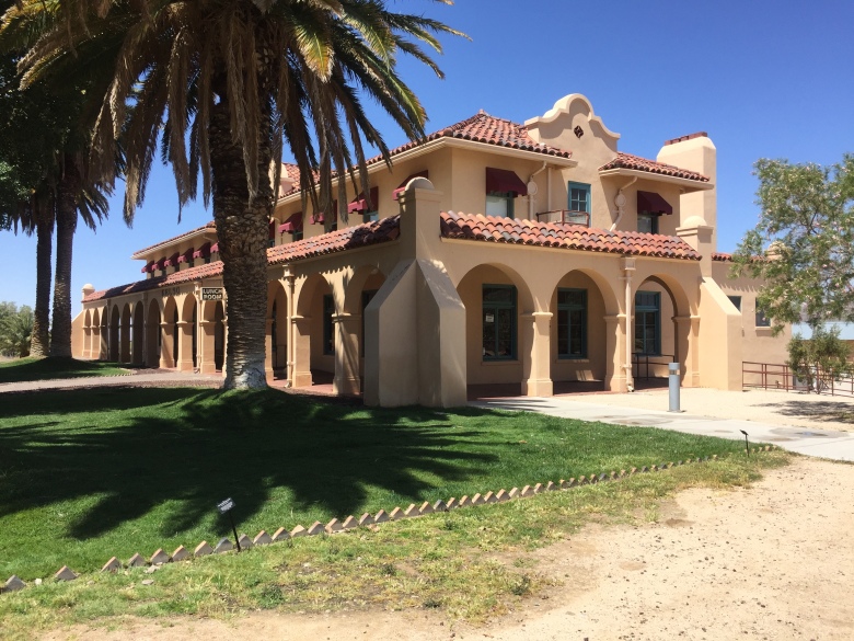
The visitor center. This building is original, but has been refurbished and returned to its original likeness. This is a real nice area. It was a bummer it was closed.
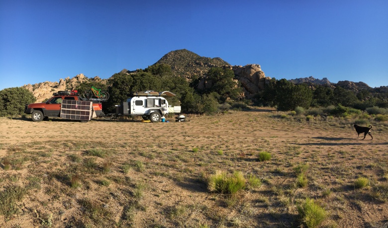
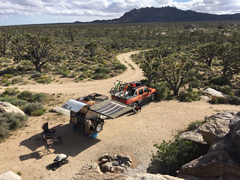
We arrived in the Granite Pass area early and had time to drive up and down the area scouting out the various camp sites in the area. I counted five. Shelley went out and scouted the first one and turned back when she ran into a swarm of bees from a nest. She spotted them with no issues, but we weren’t going to camp near by. We finally picked a real secluded spot tucked way back up into the boulders. It was a sweet location. Tough to maneuver a full-size truck and camper into, but we made it (34.808008, -115.621451). We would definitely stay in this area again.
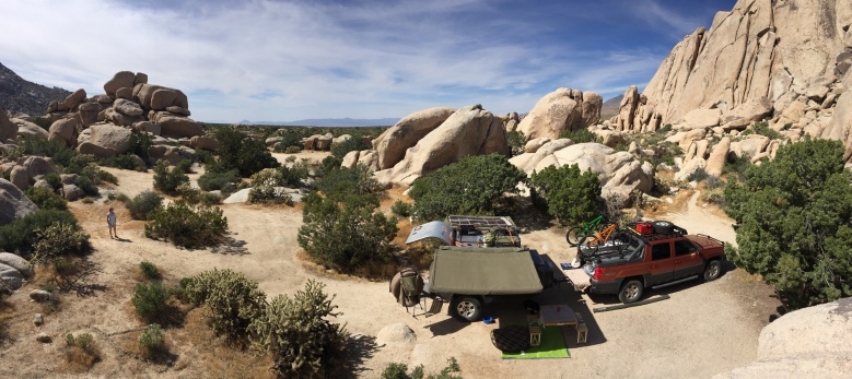
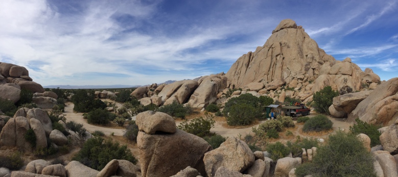
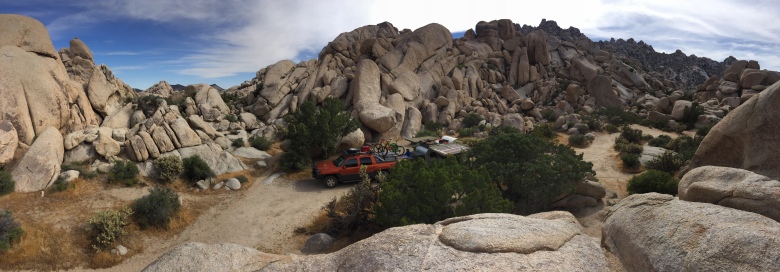
Since we stuck to the more improved roads, we made great time and had time to go explore the area after setting up our camp.
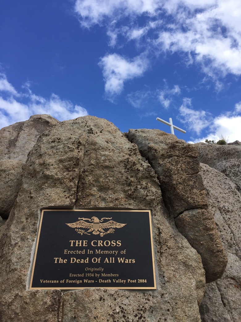
On this day we also finalized our plans on how to get the shocks fixed. We decided that we would go home via Salt Lake City and drop the trailer off at Moby 1’s shop and have them do the repairs. This decision also forced us to cut our trip short by a day as we needed to be in Springville by close of business Friday. We decided that instead of finishing the Mojave Road east from the Mojave Monument to I-15, we would stay on the Kelso Cima Rd and head north to Cima and stay near the Mojave Cross on Wednesday night. Then we would spend Thursday driving to Springville and drop the trailer off Friday morning.
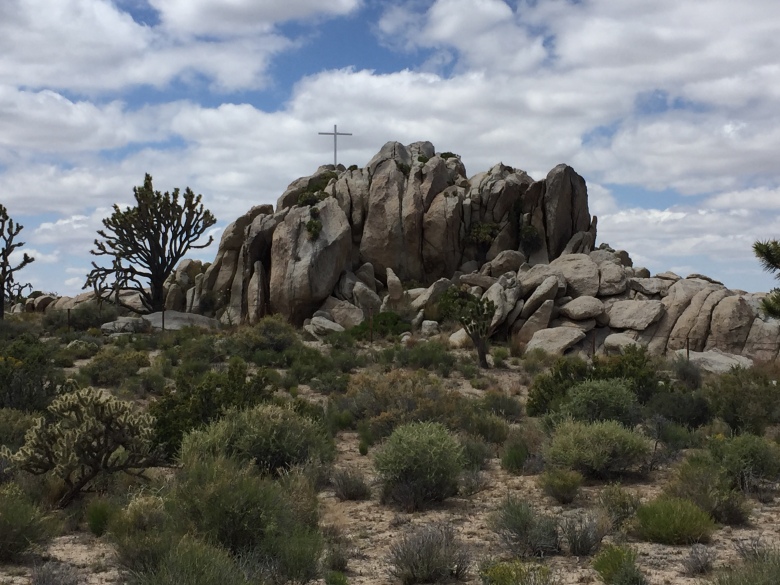
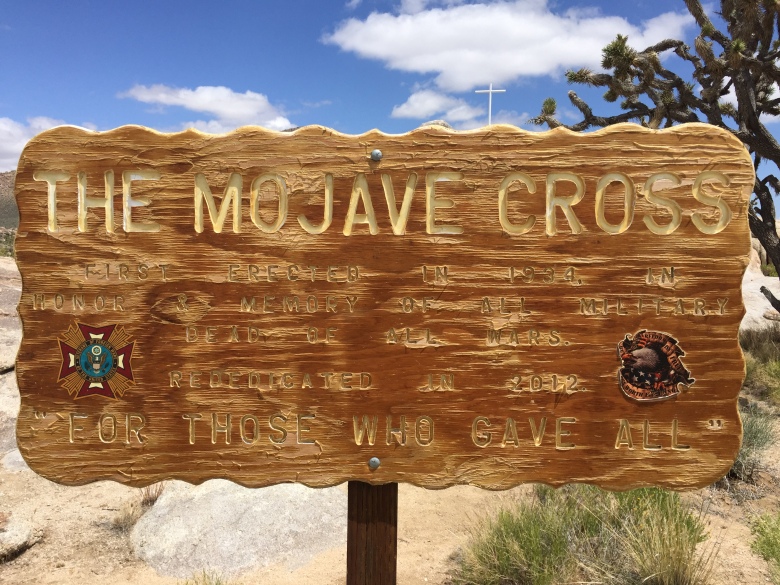
In my research of where to go and what to see in the Mojave, the area around the Mojave Cross was on my list but our original trip ran out of time and I cut it out of the original plans. So this was easy to put back in as I already scouted the area out via Google Earth. There was a nice hike in the area and good camping options.
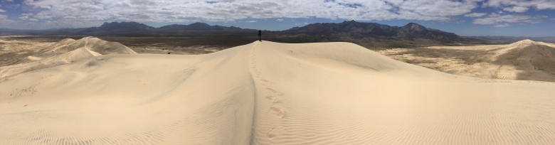
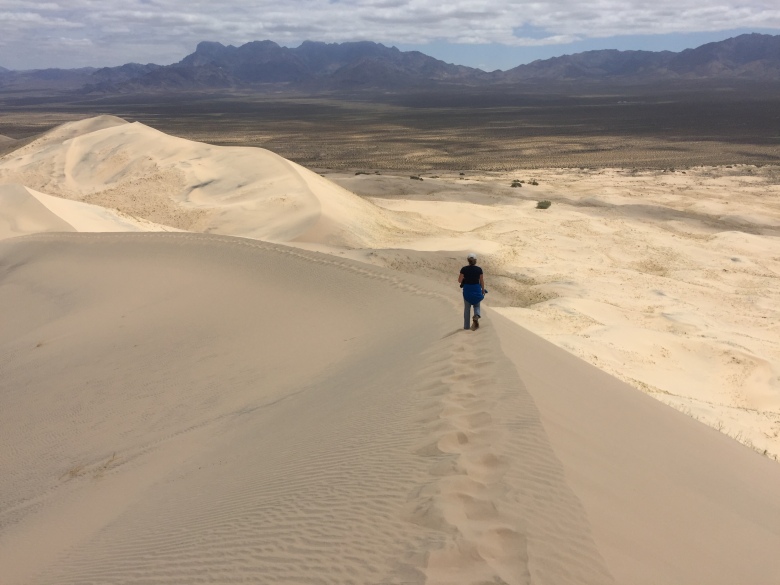
After breakfast on Wednesday, Day 3, we headed north and took a pre-planned side trip to the Kelso Dunes (34.892444, -115.699056). This was quite a hike. We had never climbed a sand dune before, which was interesting to say the least and the view at the top was pretty spectacular. No one was around but us. On the way down a visitor from Switzerland was on his way up.
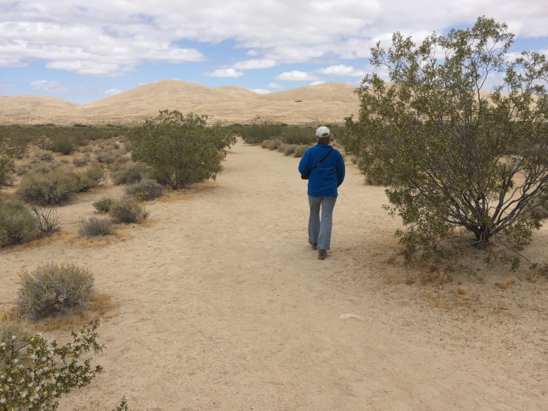
The hike only took us about 2-1/2 hours round trip. It wasn’t “hard”, but it was a bit more difficult once we started ascending the dune itself. We learned quickly that if you walk on the windward side of the summit ridge, the sand is a bit more compact and easier to walk on.
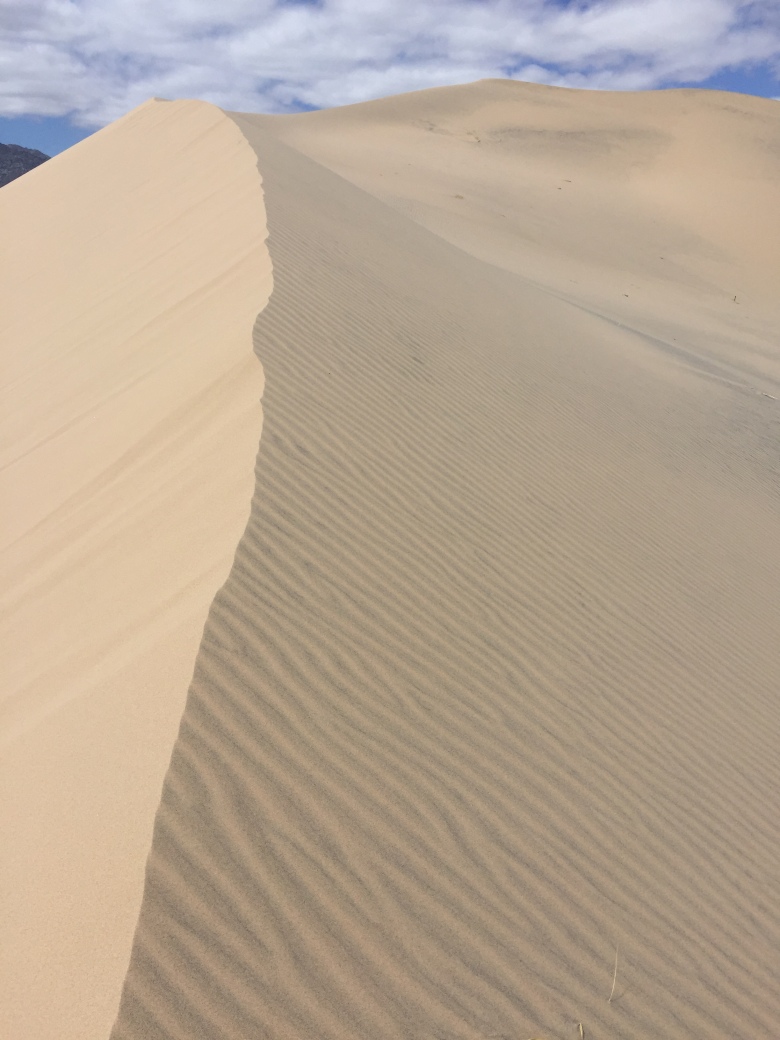
The untouched summit ridge.
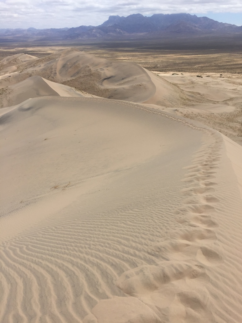
Looking back down the summit ridge.
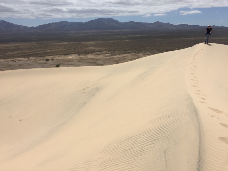
The summit is actually a combination of three ridges. In this photo, Shelley is at the top and I walked down one of the ridges coming off the summit.

The weather was really very pleasant for this trip. We got hot because of the climb, but the temperature was really nice. We put Ripley in the trailer while we were gone and turned on the fan for her. But it never got hot at all. When we got back, it was in the 60s inside.
After leaving the Kelso Dunes, we found another great camp site near the Mojave Cross. This short driving day also allowed us to go for a second nice hike over to Teutonia Peak Trail. This was another nice, mellow hike with great sweeping views of the valley floor. Not a long hike by any means.

We hung out around the camp site and explored the area immediately around the cross before dinner. There are a number of nice camp sites in this area.
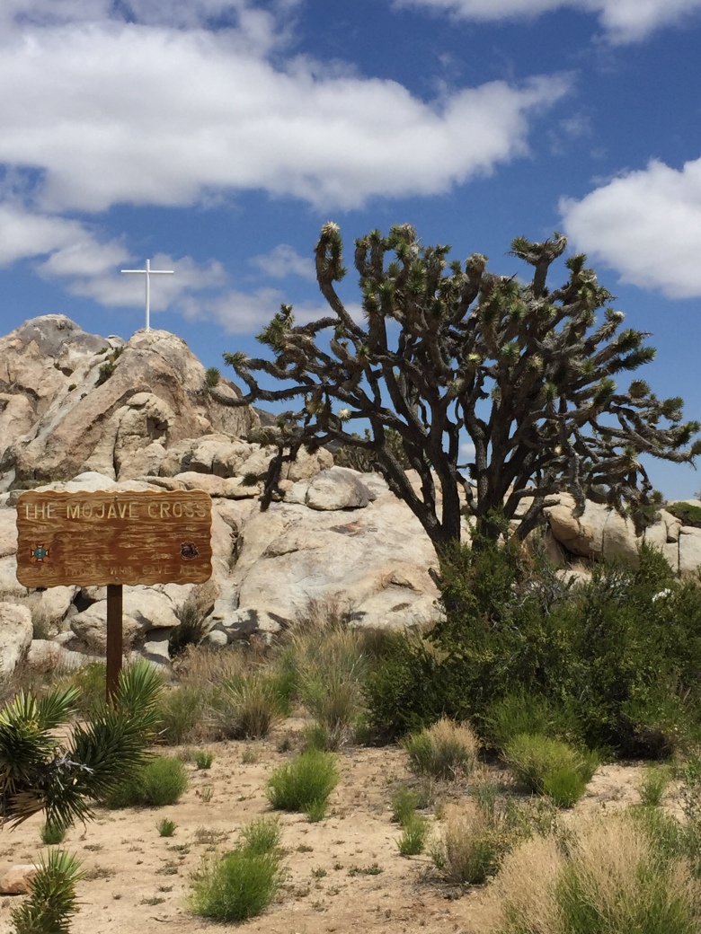
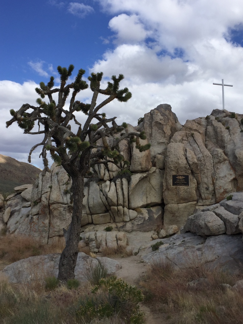
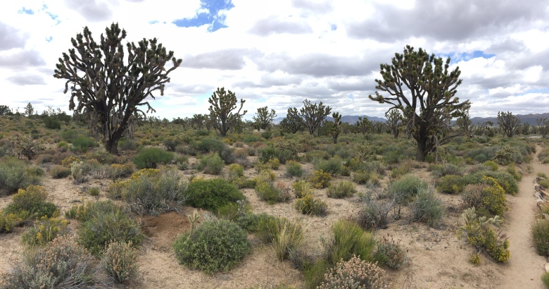
This area we stayed in is known for its large Joshua Tree forest. These were some of the coolest trees to walk through. Very different from anything we’ve ever seen. Some were smaller but others were quite large. This was the most interesting day of the trip with the Kelso Dunes and this Joshua Tree forest. And since we weren’t on the road long, we had a lot of time to explore around the area.


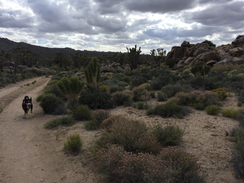
Ripley was so happy to be able to go with us as we walked around this area to check out the camp sites. She finally got a chance to stretch her legs.
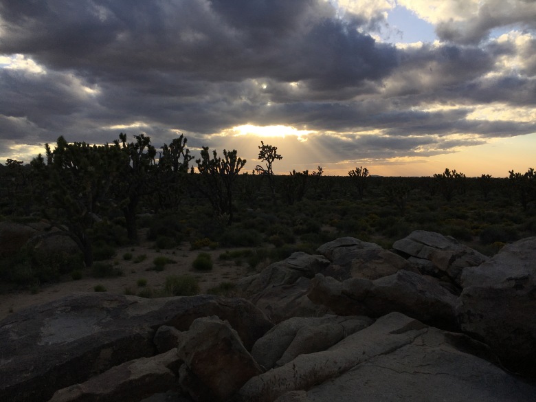
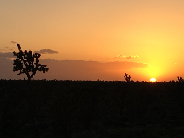
After we spent the afternoon exploring, we had dinner, relaxed and then climbed the rocks behind our camp site and watched a spectacular sunset over the Mojave.

On Thursday, Day 4, we packed everything up and head to Springville. We stayed in a KOA in Springville, took showers and got cleaned up. Had a nice dinner in a local brewery that night and dropped off the trailer at Moby 1 on Friday morning before heading home to Boise.
It was quite the trip. Fruita, Flagstaff and the Mojave National Preserve. Two weeks on the road at three distinctly different stops made for a real awesome trip. And having not finished the Mojave Road gives us ideas for a return to the Mojave Preserve in the future.

July 17, 2017 at 16:55
Very nice write-up OB #3062.
LikeLike
July 18, 2017 at 06:23
I changed it to #3062. Thanks for the kind words. Glad you enjoyed it.
LikeLiked by 1 person
June 6, 2018 at 18:33
[…] 2018 Trip started in the fall of of 2017. I wanted to complete the Mojave Road after getting cut short in 2017 but didn’t want to travel all the way to Southern California from Boise for just 5 or 6 days in […]
LikeLike